Tuesday, August 14, 2012

Abandoned Fukuchiyama Line - 旧福知山線

20120807-FukuchiyamaLineHike-3

Place Name: Abandoned Fukuchiyama Line - 旧福知山線
Type: Hiking Course ハイキングコース / Abaondoned Railway 廃線
Location: Takarazuka City and Nishinomiya City, Hyogo Prefecture, JAPAN
Starting Location Namaze Station 生瀬駅 
Latitude: 34.8561
Longitude: 135.306
Ending Location Takedao Station 武田尾駅 
Latitude: 34.819158
Longitude: 135.325058
Date of Visit: August 7, 2012
Access: JR West Fukuchiyama Line
20120807-FukuchiyamaLineHike-5

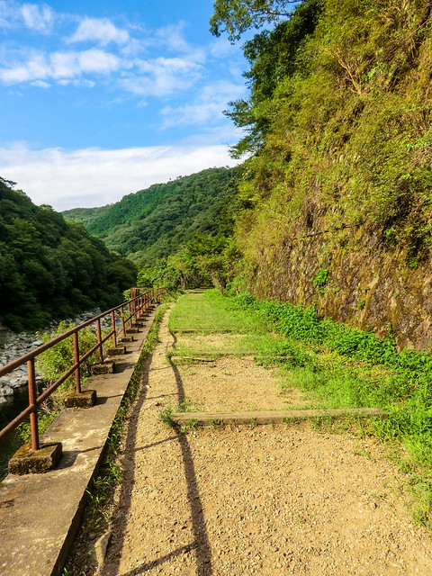
This is a hike very popular with the locals that takes you along the Mukogawa river on what use to be the Fukuchiyama line connecting Takarazuka with Sanda. It only takes a few hours and can be done easily in an afternoon. I took my daughter in her backpack and we had no problems other than a few low hanging trees. Along the route there are a few long tunnels which are not lighted so taking a good flashlight along is recommended. I was able to trick my iPhone light into staying on getting us safely through, but I won't be doing that again.

20120807-FukuchiyamaLineHike-1

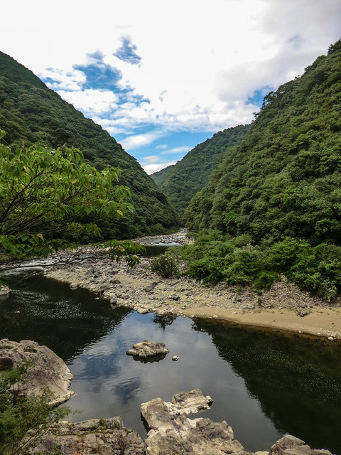
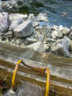
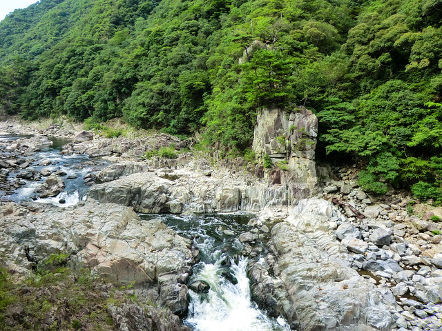
The views of the river are amazing. Great cliff walls and the tight canyon it has dug are quite dramatic. There are some rough rapids that are great to watch from above. Conversely, a few sandy beaches also look tempting, but are impossible to reach from the trail.

20120807-FukuchiyamaLineHike-420120807-FukuchiyamaLineHike-6

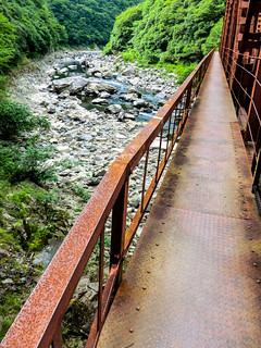
It's fun walking by all of the signs posted by JR West saying the trail, tunnels, and bridges are closed and that it's NOT a hiking course. Feel free to ignore them as the trail is very heavily used by young and old. I'm guessing that JR posts the signs to avail itself of any legal responsibly.


View Fukuchiyama Line HIke in a larger map

20120807-FukuchiyamaLineHike-2

Friday, August 10, 2012

Rinku Town Station - りんくうタウン駅


06.30RinkuTownStation-3.jpg

Rinku Town Station - りんくうタウン駅

Place Name: Rinku Town Station りんくうタウン駅
Type: Train Station 駅
Location: Izumisano City, Osaka Prefecture, JAPAN
Latitude: 34.410456
Longitude: 135.299892
Date of Visit: June 30, 2012
Access: Via Nankai or JR West
Average Daily Passengers (2010): Nankai 4,166 / JR West 2,460 
Date Opened: November 15, 1994
Web: 

06.30RinkuTownStation.jpg

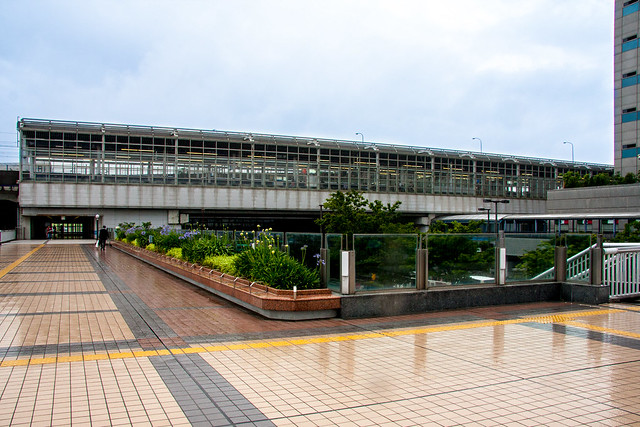
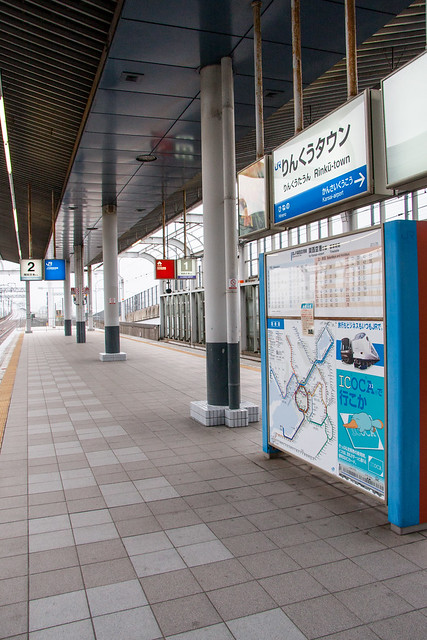
Rinku Town Station is a joint or union station served by quasi-public railway JR West and the privately held Nankai on their shared lines that access Kansai International Airport. A second jointly operated station in the airport is the only other station on the line. It is not rare for the private railways to operate jointly as they have a uniform ticketing system and various trackage agreements. The rarity of Rinku Town Station is that it's a joint station between JR and a private railway. Typically in situations like this where JR and private lines meet there will be a separate building (e.g. Sanda Station) or a no-mans-land built between the two stations (e.g. Tsuruhashi or Shin-Imamiya). 

06.30RinkuTownStation-5.jpg

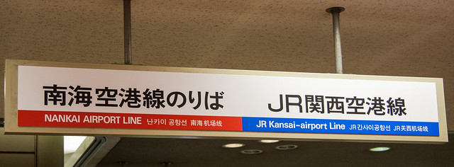
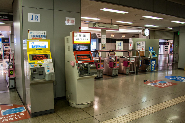
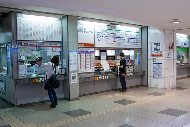
As mentioned above, the private railway lines in Kansai are for the most part members of a uniform ticketing system which includes an IC card (PiTaPa) while the JR lines work on their own system with their own IC card (ICOCA). Since the JR and private ticketing systems are not interoperable  there are two separate sets of turnstiles. There are also separate ticketing windows and fare adjustment machines.

06.30RinkuTownStation-4.jpg

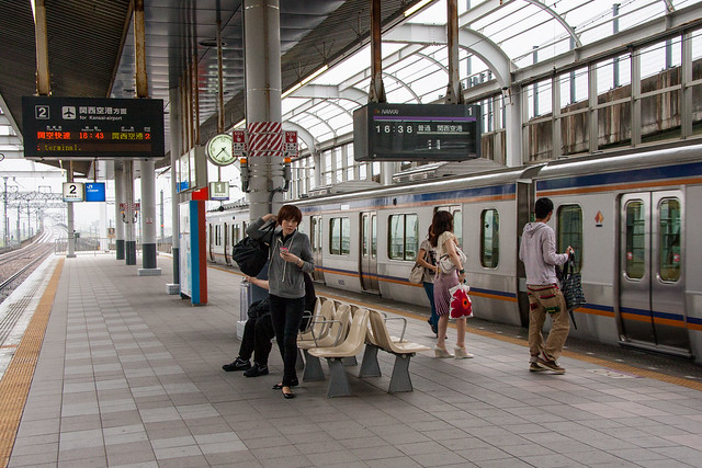
While both Nankai and JR West trains use the same platforms at Rinku Town Station at the airport the platforms and turnstiles are separated. You will not be able to exit the station with a Nankai ticket from the JR side, conversely the opposite is also impossible. Be careful because you might have to travel back to Rinku Town to get on the right train then return to the airport.

06.30RinkuTownStation-2.jpg

The station has a small shopping center inside and has access to two malls aimed at shoppers coming to or going from the airport. One of the malls has a Ferris wheel and Rinku no Yu, a supersento. There is also a sento, Nagomi-Yu, within walking distance.

06.30RinkuTownStation-6.jpg

Sunday, May 27, 2012

Yaominami Station - 八尾南駅

Place Name: Yaominami Station 八尾南駅
Type: Train Station 駅
Location: Yao City, Osaka Prefecture, JAPAN
Latitude: 34.597389
Longitude: 135.582569
Date of Visit: May 4, 2012
Access: Last station on the Tanimachi Line (谷町線)
Hours: 5:01~23:21 (First train to last train)
Passengers: 11,445
Date Opened: November 27, 1980

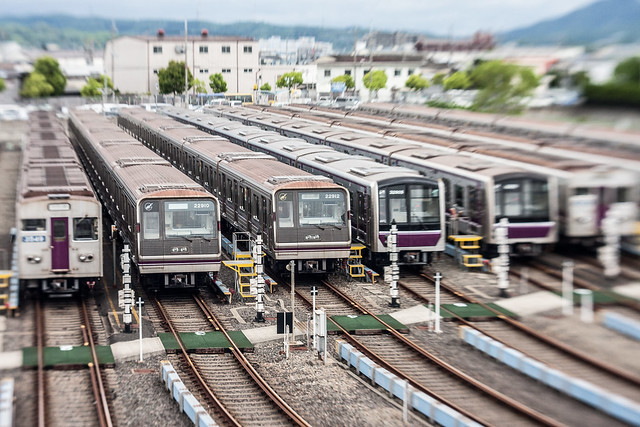
Yaominami Station is the terminus of the Tanimachi Line of the Osaka Subway. The Tanimachi line rail yard is located here. 

20120504-YaominamiStationArea-2
Tanimachi Line Rail Yard
20120504-YaominamiStationArea-1
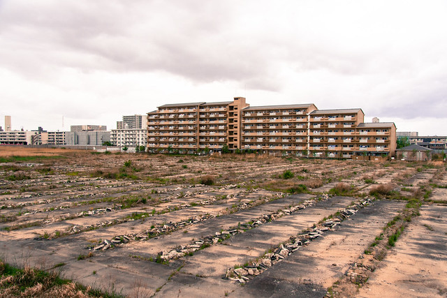
Empty Field and Apartment Building
20120504-YaominamiStationArea-4
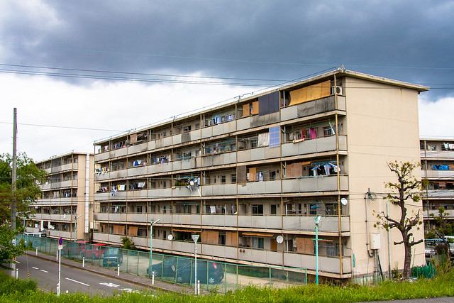
Public Housing Building, Yao
20120504-YaominamiStationArea-3
Drainage, Yao

Sunday, May 13, 2012

Okadera 岡寺 - Saikoku #7

20120501-untitled-6
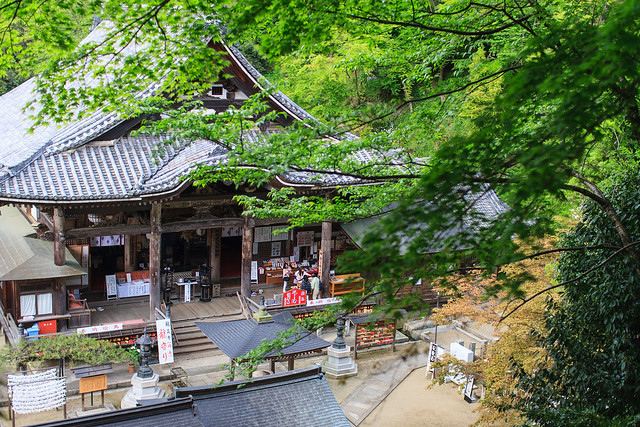
The Hondo of Okadera

Place Name: Oka-dera 岡寺
Type: Temple 寺
Location: Asuka Village, Nara Prefecture, JAPAN
Latitude: 34.471789
Longitude: 135.828372
Date of Visit: May 1, 2012
Access:
Take the Nara Kotsu bus from Kintetsu Kashihara Jingu Mae (橿原神宮前) east exit. Do not use Kintetsu Okadera station.
or
Walk 3~4km from Kintetsu Asuka (飛鳥) [This is the route we took. -David]
Fee: Adults ¥300
Hours: 8:00~17:00 (8:00~16:30 December through February)
Okadera is tucked into a small v-shaped gorge cut into the mountains forming the eastern edge of Asuka village, one of the ancient capitals of Japan. The village itself is a candidate for world heritage status. From the valley floor the temple is located at the end of a steep paved access road dotted with a few omiyage stores, tiny restaurants and minshuku aimed at pilgrims, but mostly private residences, abandoned houses and forest.

20120501-untitled-3
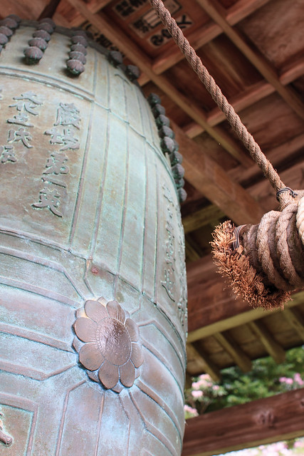
The temple bell

Behind the main gate is a set of stairs that leads to the temple grounds. The temple faces south and is built up against the slope behind it. In front of the temple is a four sided bell tower. Visitors are encouraged to sound it, with a small donation of course. Ringing the bell and focusing on the sound helps one calm down and get into right mindset to best enjoy this peaceful place. The temple itself does not have a bell to ring when you make your prayers like most do.

20120501-untitled-1
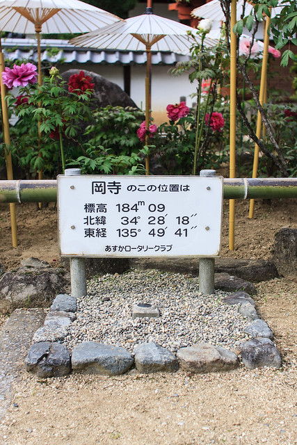
You are here


Inside the main temple building the enshrined image, a Nyorin Kannon, is the largest clay statue in Japan at 4.85 meters tall. The temple’s website clams the clay was made with soil from Japan, China and India. It was built at the end of the Nara era, which lasted from 710 to 794.

Okadera was founded in 633 and originally called Ryugaiji (龍蓋寺) literally, “dragon lid temple.” It was named as such for the pond on the temple grounds which was thought to be the home of a dragon. This dragon was not a destructive one however. In times of drought the lid was, metaphorically, opened and the dragon released to bring rain.  The pond still exists in front of the main temple building and is home to more than a few real carp. A single stone island shoots up from the murky waters and is wrapped with rope and paper in the Shinto style signifying spiritual significance. Perhaps as a manifestation of the dragon that sleeps below.

20120501-untitled-4
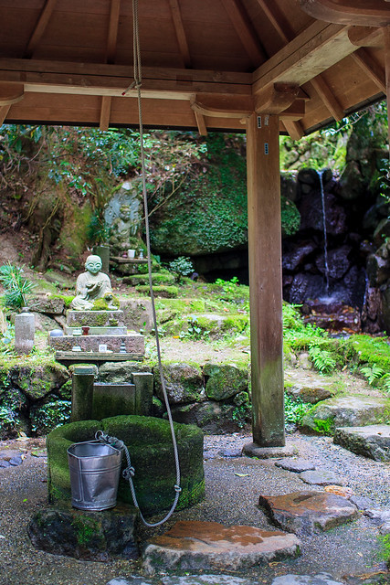
Well and Waterfall

Beyond the temple further into the mountains is a loop trail that that follows a small stream then climbs the slope on the opposite side of the main temple. First along this path is a tiny waterfall and well. There is no sign saying whether the water is safe to drink or not, but one sign does ask that you do not leave the bucket in the well.

20120501-untitled-5
Okunoin

Further back behind the well is the Okunoin (奥の院). This is the actual heart of the temple. Okadera’s is unique because of how accessible it is and because it’s built into a natural cave. Deep in the back of the cave is statue of Maiterya, a Buddha who will come to Earth in the in the future.

20120501-untitled-7
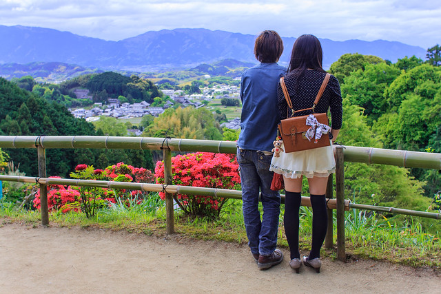
Looking west across the Nara Plain

After reaching the Okunoin the path heads up into the forest overlooking the main temple grounds. The trail passes a few gravesites and monuments and peaks at view looking west towards Asuka village and the mountains that make up the western border of the Nara Plain.

20120501-untitled-2
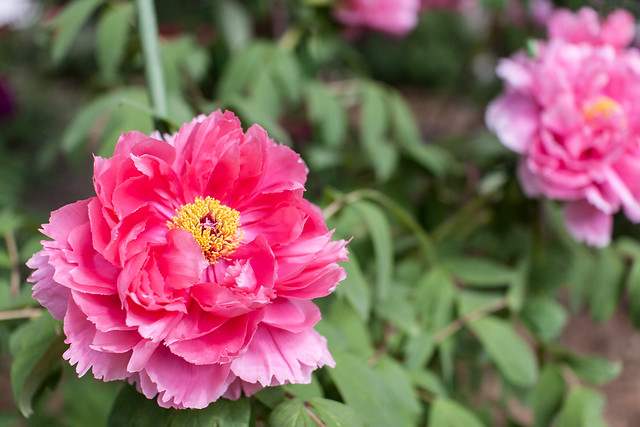
One of Okadera's 3,000 rohdodendrons

In spring the 3,000 rhododendrons (シャクナゲ) planted throughout the temple grounds bloom. Some plants are even shaded by white paper umbrellas to protect the flowers from the weather. They are typically in full bloom around Golden Week.

[One of the first temples I visited when accompanying my mother-in-law as she completed the Western Japan 33 route was Okadera. I had been to many temples before then but mostly large ones on the foreign tourist routes. Going to Okadera really kindled my interest in temples and has led to our family going on the pilgrimage ourselves and exploring many wonderful places. -David]
20120501-untitled-8
The village of Asuka as seen from Okadera

Saturday, April 28, 2012

Yoshimine-dera 善峯寺 - Saikoku #20

20120416-Yoshimine-dera-2
The Main Gate

Place Name: Yoshimine-dera 善峯寺
Type: Temple 寺
Location: Nishikyo Ward, Kyoto Prefecture, JAPAN
Latitude: 34.938172
Longitude: 135.644203
Date of Visit: April 16, 2012
Access: Hankyu Bus #66 from Hankyu Higashi Muko station or JR Muko-cho station
Fee: Adults ¥500 / Parking ¥500
Hours: 8:00~17:00

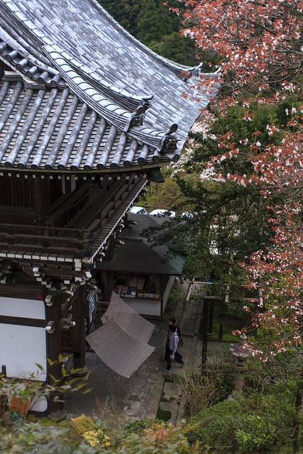
Every temple in the Saikoku 33 pilgrimage is a special place. The surrounding landscape, as I have mentioned before, is equally unique. The monks who nearly 1,000 years ago that established this temple also must have found the landscape intriguing enough to warrant such an outlay of labor, material and treasure to build these amazing complexes. Yoshimine-dera is located up a steep, tight valley west of downtown Kyoto. It’s on the opposite side of the Kyoto basin of the much more popular and well-known Kyomizu-dera. While being listed on some of the Kyoto city tourism websites in English this was my first time hearing of it, and that is only thanks to its inclusion as the 20th temple in the Saikoku 33 temple pilgrimage.

20120416-Yoshimine-dera-6
The terraced garden

Driving up to the temple requires trust of your maps and car navi. Kyoto, in general, is much tougher to drive in than any other area in Kansai. Small streets that really should be alleys and the local drivers who take them at breakneck speeds. After passing under the currently under construction Kyoto Jyukan Expressway the temple road (京都府道208号) really begins to pick up elevation. Along the way are signs advertising bamboo shoots (takenoko 竹の子) that are harvested from the surrounding forests. The neighborhoods on the foot of Mt. Nishiyama are locally famous for this spring vegetable. We picked up a decently sized bag for ¥1,000. The road’s steep final accent leads to two parking lots. The older lower lot has a good set of switchbacks to get to the temple, or you could skip them and use the upper lot.

20120416-Yoshimine-dera-5
Looking down on the Yuryu no Matsu

The temple complex takes 30-40 minutes to walk through and covers 30,000 tsubo or about 9 KM2--if I converted that correctly. The two guardian king statues that are placed on either side of the main gate were made by Unkei a Kamakura era sculptor. His painterly statues are considered some of the best in Japanese art and include many national treasures some of which are kept in the treasure hall in Kofuku-ji in Nara. From the main gate where the entrance fee is taken it’s a short walk to the main temple and where you get your scroll signed as we did. The main temple building is majestic and beautiful, but is overshadowed by the surrounding buildings and gardens.

20120416-Yoshimine-dera-1
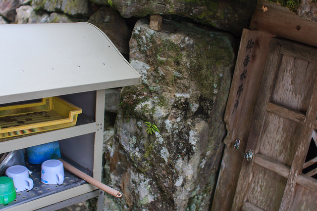
Okozui Well

Directly to the right of the main temple a door is built into the rock lined retaining wall. Behind that door is a natural well. The water, known as Okozui (お香水), is used in offerings to Buddha and believed to extend ones life. Next to the door is a tray for monetary offerings, a selection of cups, funnels and some ladles. Nearby, hidden under the temple stairs were a few 2-liter plastic bottles, the stash of temple visitor who left them there to fill up after they walked the grounds. The water was cool and had a soft feel in the mouth. It is rare that one can drink water that is unprocessed, un-bottled, untouched by anything other than nature. Drinking this well water alone makes the trip to Yoshimine-dera worthwhile.

Making prayers and the water here is also said to help cure neuralgia and chronic lower back pain. In fact, the temple used to offer a prayer and bath service once a month to the faithful. Sadly the service has been cancelled.

20120416-Yoshimine-dera-4
Yuryu no Matsu

There are many other natural treasures found in the temple grounds. Sakura, ajisai, and momiji among other flowers are all cultivated on the grounds and attract viewers when they are in bloom. The most famous and greatest natural attraction is the 600 year old Japanese white pine, Yuryu no Matsu (遊龍の松). This tree spreads out in a flat 90-degree bend over along a terrace above the main temple. It is like a giant human sized bonsai tree. The age of this magnificent tree can be seen in its twisted knotted wood. Just like the bristlecone pines of California’s eastern Sierra, the Yuryu no Matsu has a sense of wisdom and age that is instantly apparent from first sight.

20120416-Yoshimine-dera-3
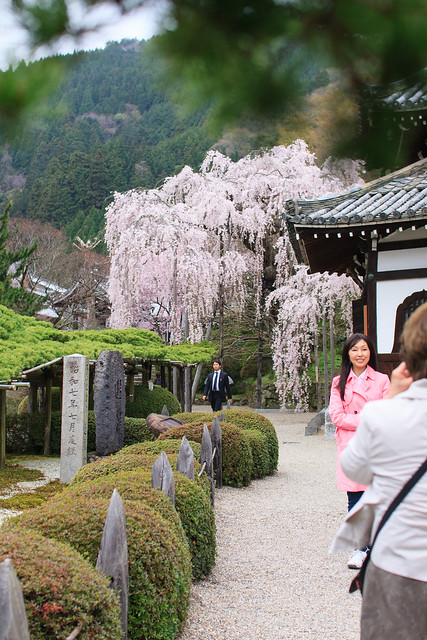
Yuyru no Matsu and a Weeping Sakura

Other gardens, temple buildings, small shrines, pagodas, and a toilet with an amazing view of downtown Kyoto, including the oft-maligned Kyoto Tower, are all here for exploration. Every one of the Saikoku 33 temples is an extraordinary place, but some are so amazing that they should be visited whether you are on the pilgrimage or not. Yoshimine-dera is one of those temples.
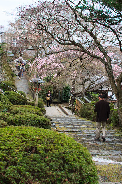
20120416-Yoshimine-dera-7
Looking towards the main gate

Sunday, April 22, 2012

Sleepytako’s list of amazing, interesting, odd, strange, out of the way, and extraordinary places.

20020422-Douglas-WY-LiquorStore
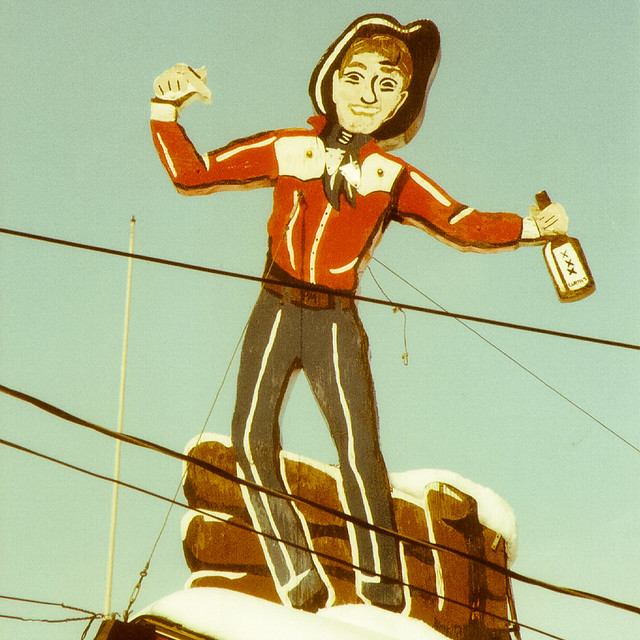
Douglas, Wyo Liquor Shop Sign.


I’ve been writing this blog for 6 or so years now and I decided I needed to give it a theme--a reason for being. I’m going to rebrand the blog from a disjointed connection of posts about living in Japan to something more solid. From now on this space will feature some of the amazing places that I’ve traveled to throughout Japan and the USA. There are so many places I have had the pleasure to explore and I wish that many of my readers could enjoy too. I’ve already turned my onsen and sento places into their own website with I Love Yu, why not also document all the non-sento places in the same way.

I’ll also be continuing my guide to exploring Japan using the Seisun 18 Kippu.

I hope you find it helpful and interesting.

Yours,
David

Hopp by Ylva Krantz

Hopp by Ylva Krantz by sleepytako
Hopp by Ylva Krantz, a photo by sleepytako on Flickr.

My photo of students jumping during their sports festival has been painted by an artist in Sweden.

I love the wood showing through. It's something that I use to do when I painted, but I never painted anything as good as this.

I'm honored that anyone liked my photo this much.

Thank Ylva!

Original Photo: www.flickr.com/photos/sleepytako/3992874384/

Thursday, April 19, 2012

Truth or Conseqences, NM

20120328-TorC-NewMexico-2
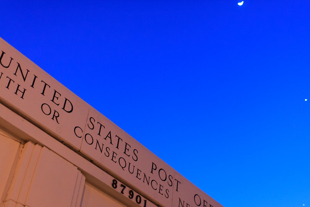
Signs in the twilight.


Place Name: Truth or Consequences
Type: City
Population: 7,289 (2000 census)
Location: Sierra County, New Mexico, USA
Latitude: 33.133611 
Longitude: -107.252778


Truth or Consequences. People hear of this city because of the movie of the same name or on a list of strange addresses next to DISH, TX and Santa Claus, CA. I doubt many actually visit. The history of the name change is simple enough: tourism. A popular TV game show in the 1950s promised a visit from the host and other promotional benefits if a city would name itself after the show. T or C, as the locals and the Weather Channel calls it, was thus born.

In a sense the name encapsulates the anything for a buck Western capitalism and the harsh reality of living in the arid and unforgiving environment.

T or C was originally named Hot Springs after ample springs and man made wells that tap into the aquifer below. The springs make up an important part of the city's tourist based income. Many hotels and small resorts in the old downtown area cater to America's small but enthusiastic hot spring community.

Today the city is a very Western mix of a sleepy old town lost in time, hippies and counter-culture, and Jeffersonian individualism with a heavy Hispanic influence. The one main supermarket still used the square carts I last saw in the early 1980's when I was in kindergarten. The Walmart up on a hill near the interstate only opened two years prior to our visit. There's a spattering of chain restaurants and shops but many local establishments still remain. The local hamburger drive-in still serves malts and closes at 8. 8:30 on the weekends.

We spent two nights there in a small converted motor-court turned unique hotel with a private outdoor bath out back. Our days mostly spent in the spring or being lazy in the hotel. Besides the springs, the English accented lady at the tourist information office suggested having a picnic at the local ghost town 45 minutes down the road which we enjoyed.

T or C with it's unique geological features, preserved downtown with some great old buildings still in use and it's beautiful landscape makes it worth inclusion on my list of extraordinary places. No wonder J.B. Jackson chose New Mexico for his home. 
Date of Visit: March 28 ~ 30, 2012

20120328-TorC-NewMexico-1
The beautiful, Romanesque U.S. Post Office. Looking at this building makes one yearn for the ideal America that you know could exist.
20120328-TorC-NewMexico-3
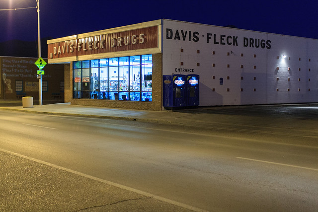
Signage for the local drugstore in a style that was once ubiquitous but now rare in the metropolitan areas of the west.
 

Tuesday, March 27, 2012

The Tiny Trains of Kintetsu

20120225-UtsubeHachiojiLine-5
Utsube Station

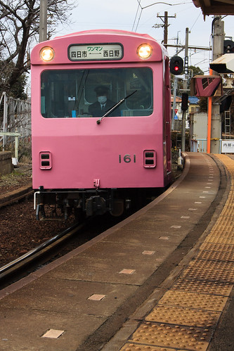
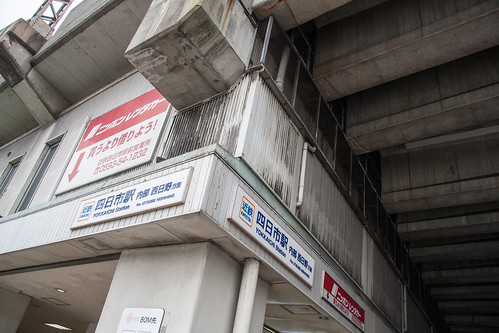
A small single platform is tucked underneath the elevated tracks for the Nagoya and Yunoyama lines at Kintetsu Yokkaichi station. The large elevated tracks serve the normal gauge trains sending passengers on long express trains to Osaka and Nagoya. Down below are their little brothers Kintetsu’s Utsube and Hachijoji lines. In Yokkaichi are two of Japan’s four narrow gauge trains. The tracks are noticeably closer to each other, but it’s not until the brightly colored train pulls into the station that you realize just how narrow these trains actually are. It looks like the trains were bought in a closing sale from a failed Disneyland knock-off. The driver situated in the middle of the car seen in the front windshield seems too big for his little train.

20120225-UtsubeHachiojiLine-420120225-UtsubeHachiojiLine-6

The train stops and is quickly filled by the people waiting on the platform. It’s a tight fit for this mostly full train. The front and rear cars have a row of single seats along the sides while the middle car has a typical bench. The seats cannot change directions. If you are sitting in the back of this train you can watch the world drift away and only with a strained neck and twisted body can you see what is coming next. A change machine is at the far end behind the driver. Fares are collected by that driver at all stations except Utsube and Yokkaichi where the station is manned. PiTaPa is not accepted.

20120225-UtsubeHachiojiLine-2
Utsube Station

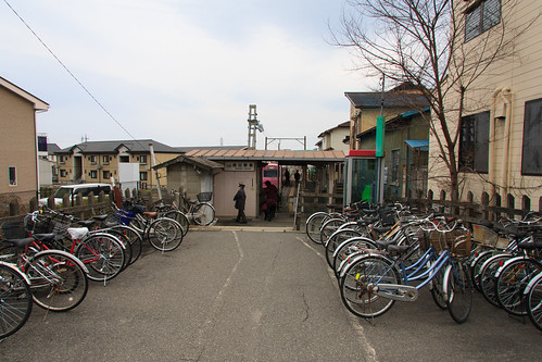
There are two lines the Utsube and the single stop spur Hachijoji line. The latter originally traveled further into the countryside but was abandoned after a flood in the 1970’s. Both traveled into a mix of light industrial with residential neighborhoods of mostly single-family houses. I was pleasantly surprised how busy the lines were on the Saturday that I rode them both. Local ridership appeared high. At Utsube station, the terminal, riders exit through the small house that serves as the station while a few who remain loiter around. These are the train fans walking along the platform snapping photos as they wait for the return trip to Yokkaichi. A grandfather tells his grandchild about the train as he peers out the window. These trains, because of their rarity, are popular among train enthusiasts.

20120225-UtsubeHachiojiLine-7
Nishihino Station
There did not seem to be much to see along the two lines other than trains themselves. The old wooden stations, especially Hinaga where the lines diverge, are quite pretty. These are some of the most unique trains in Japan and a pleasure to ride if you find yourself in Mie.

Wikipedia:
Utsube Line
Hachioji Line
20120225-UtsubeHachiojiLine-3

20120225-UtsubeHachiojiLine
Yokkaichi Station
The Utsube and Hachioji Lines are in blue and dark green respectively.
より大きな地図で Kintetsu Trip Feb 25 2012 を表示

Saturday, March 17, 2012

6670.1 Kilometers

20060104-IchibataIzumotaisha-1
Ichibata Electric Railway, Izumotaisha-mae Station

I put together a spreadsheet of all the train lines I've ridden in Japan.

As of today my grand total is:

6,670.1km
(4,144.6mi)

Below is the entire spreadsheet in Google Docs. I'm quite proud of this accomplishment for what it's worth.

Click here to view the spreadsheet full screen.

Sunday, March 11, 2012

3.11

03.31KenrokuenSakura-1 by sleepytako
03.31KenrokuenSakura-1, a photo by sleepytako on Flickr.
May those who lost their lives be remembered and those who have been displaced be comforted.

Saturday, March 03, 2012

Seishun 18 Kippu Pt.2: Planning 青春18切符

This is the second of a series on using the Seishun 18 Kippu to explore Japan. You can see the first post here.
08.09Bingo-OchiaiStationTrain-1
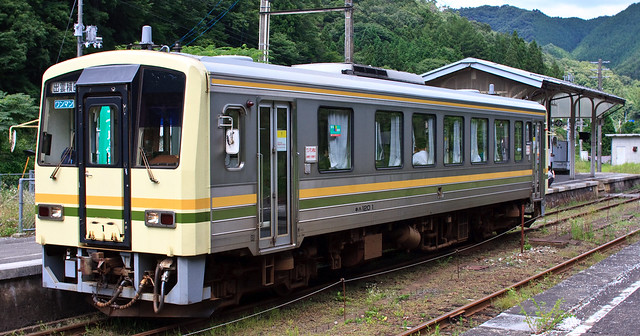
A train at Bingo-Ochai Station (備後落合駅) in Rural Hiroshima Pref.
In planning my trips I use three rules.
  1. Make the best use of your money. For the Seishun 18 Kiipu, travel more than 2,300 yen in a single day. 
  2. Maximize the amount of territory covered. 
  3. Make sure include some breaks for some adventuring on foot and gathering provisions. (beer, snacks, bento
The Seishun 18 Kippu mentioned in Part 1 costs 11,500 yen, which is a great way to start planning your adventure. 11,500 divided by five is 2,300. To get your money's worth out of the ticket you have to travel at least 2,300 yens worth. It's really not too hard to do that if you ride a train for a few hours or if you are doing a single day return trip. I'm always checking my planned routes against the magic 2,300 number.

It is important to remember that you have five days to use also. I have found that using them all at once can be tiring. What’s worked for me is four days and then use the last one for a day trip. Or a three-day trip and a two-day trip a few days later. One of my long-term goals is to ride, at least, every JR line in Japan and as many of the private railways as possible. To complete this goal I try to maximize my journeys as to travel as much as possible on lines I haven’t been on before. This is all about my quirky goals and you are, most likely, not as manic-obsessive about this like me.

 Riding a train for five hours straight will fatigue you. A good break and walk around outside is worth it. It’s during these breaks that you will have time to get food, beer, and snacks. Grab a smoke if you are so inclined. Most important, this is a chance to get a better look at the landscape that you have been traveling through. And, although the majority of these trains will have bathrooms on board, I think we can all agree that we would rather use one that’s not rumbling while risking giving up your seat.

So in this post I’ll talk about planning your trip using those three rules.

Rule #1 Travel more than 2,300 yen in a single day. 

iPhone Norikae Apps
The easiest way to check prices for distances is using any of free the online train route websites (norikae annai 乗り換え案内). My favorites are Jorudan, Google Maps, and Hyperdia all of which have English interfaces. I prefer using the Japanese sites for many reasons mostly because some of the romanji station names are strange and that the Japanese sites have more options. For those stations that have difficult kanji, I recommend finding them on Google Maps clicking on the station icon and cutting and pasting the names into the sites. Searching the stations name on the Japanese Wikipedia is also helpful as a phonetic spelling in hiragana and sometimes in romanji typically follows the station’s name in Kanji. Remember when searching that you limit your search to JR trains only for the Seishun 18 Kippu.

For iPhone users the built in routing via the Maps app works well, but for more control the free version of the 乗換案内 (Norikaiannai) app from Jorudan is hands down the best. A good alternative, although it is ad sponsored, is 駅すぽあと (ekisupoato).

The cost of a journey is calculated regardless of when you travel as the costs are defined by distance. To make sure I hit that 2,300 yen a day target. I search a general route typically with Jorudan in their Seishun 18 Kippu search to see if the distance covered will cost a sufficient amount.
02.19TicketsMaps-4
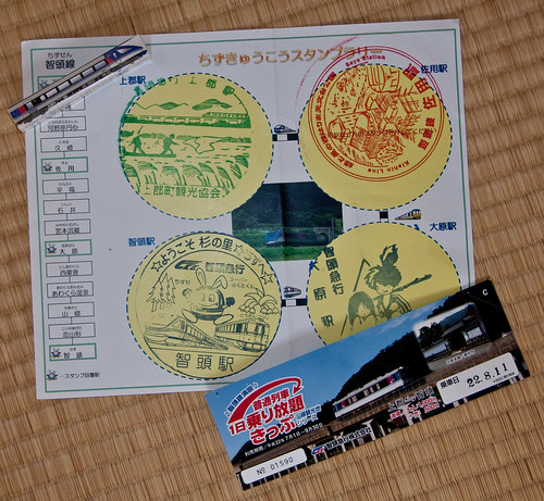
ChizuKyuko's norihodai ticket with stamp rally sheet and eraser.
Another worry is that sometimes JR trains run on what is known as Class Three Railroads that lease access of their lines to JR for their express services. Two examples are the Chizu Kyuko line in Hyogo and Tottori prefectures and the Ise Railway in Mie both of which allow JR express trains run on their lines with the costs included in the ticket price, but the local trains are run by the railway companies themselves. The Seishun 18 Kippu will not cover any segment of your trip on these lines. There are some deals to be aware of. Chizu Kyuko offers a single day norihodai, all you can ride (乗り放題), pass for riders coming to their lines on the Seishun 18 Kippu for 1,000 yen offering a slight discount on a normal one way ticket for the length of their line. They even had a stamp rally and gave out an eraser, hand towel, and stickers for completing it. These Class Three Railroads are few in number however and it can be a safe bet that you’ll not end up on one unless you are actively trying to.

Rule #2 Maximize the amount of territory covered. 
02.19TicketsMaps-5
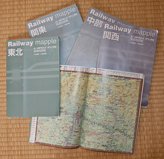
Railway Mapple
This requires a map. Google does a decent job although it can be hard to focus only on the train lines when zoomed out. The graphic JR route maps are useful but lack English in rural areas and don’t represent distance. The best map series to plan and take with you on your trip is the Railway Mapple. There are seven in total covering the regions of Japan. They are small and light enough to fit in your bag and also have enough detail to get your bearings in the larger cities. Every station has its name in hiragana and kanji written along with the distance between stations in kilometers. It is easy to get an idea of what kind of territory each line covers. Tunnels, interesting views, tight curves, and steep inclines are all listed using icons that are understandable even if you cannot read kanji. I typically take trips into rural areas but if you are traveling into a larger city I recommend Shobunsha's series of compact maps. Even though they are all in Japanese they are much more detailed than any English language map available and used together valuable to navigation. But I’m getting ahead of myself here.

02.19TicketsMaps-2
Shobunsha compact maps
Rule #3 Make sure include some breaks for some adventuring on foot and gathering provisions. (beer, snacks, bento

It's important to take a break from being on the train. Ekiben, omiyage, jizake, and jibiru for eats and tips for exploring a the ekimae area while you're waiting for the next train will be covered in the next post.

Thursday, March 01, 2012

Yokkaichi City, Mie

02.25Yokkaichi-Mizushobaichi3.jpg
Behind A Ramen Shop - Yokkaichi, Mie
I recently got a Holux GPS logger to help make maps of my trips and geocode my photographs. Trying to do the latter led me to download and tryout the new Lightroom 4 beta. I've been using Lightroom since 1 and currently run 2.7. The improvements in 4 are wonderful, although the publishing to flickr is a bit confusing. Most likely I'll sick with Jeffrey Friedl's plugin. I'm extremely happy about the lens correction that gets rid of a lot of the warping and stretching that always annoyed me about my zoom lens. These three photos are a bit of a test for my new workflow.

02.25Yokkaichi-Mizushobaichi2.jpg
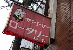
Tory's Gets a Kiss - Yokkaichi, Mie
I took a stroll down through the shotengai and nightlife district in front of Kintetesu Yokkaichi station last Saturday. The mizushobai district was quite large for the size of the town. There were some interesting snacks. The Suntory Tory's character making an appearance on a snack sign. while another nearby snack was called 酔人 "Drunk Person." There was also a pretty beat up looking x-rated movie theater down a little alley. All of this next to the city's children's park which had a really fun looking playground and rental riding toys. Gotta love spatial relativism.

02.25Yokkaichi-Mizushobaichi1.jpg
Ropponica Theater - Yokkaichi, Mie
This was my first time to explore a Mie, Pref. city since walking around rather rural Kameyama a few years back. I was surprised how modern and clean the most of Yokkaichi's ekimae was. With many new buildings and pedestrian walkways. The influence from Nagoya was noticeable here just as the lack of influence was when I arrived in Matsusaka later that day. I was surprised to see a Lalaport run mall, an Animate store, and Vedett-a white Belgium beer-being advertised by a modern looking bar all right there next to the station. However, this modern, clean Japanese landscape quickly faded into the shotengai and mizushobai streets to the east and the old neighborhoods to the west. Not to mention the very bubble-esque  Kintetsu department store that served as an anchor to the entire area.
Friday, February 24, 2012

Boulangerie Miyanaga : Sleepy Restaurant Review

02.04-miyanaga
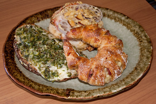
A green onion topped croque-monsieur, crescent shaped ham and cheese, and a ham and lotus root bread.

Opening sometime last year Boulangerie Miyanaga in front of the smaller north exit to Hankyu Shukugawa has quickly become my favorite bakery here in Japan.

Miyanaga doesn’t make soft bread. This is real tough bread. Californian, European style crusty goodness. Not only is the bread wonderful, but also the stuff that’s mixed into it is equally good. Herb chicken, real cheeses, walnuts, Tanba black beans, cranberries, ham and more all in very, very generous quantities mixed into the breads here for very reasonable prices. Miyanaga isn’t cheap, but you’re not gouged and you get your value for your yen. Besides bread they also make some of the best quiches that I’ve had anywhere.

My recommendations:
-Curry pan
-Herb chicken
-Cheese and bacon quiche
-Plus the three that are in the photo

Boulangerie Miyanaga
Hours: 9:00 ~ 20:00 Holiday: Every Wednesday + Every Third Tuesday
Address: 兵庫県西宮市相生町7−3夙川第一ビル1階
Web: www.boulangerie-miyanaga.com


大きな地図で見る