Sunday, October 27, 2013

20 Year Ago Today - the 1993 Laguna Firestorm

20130820-LagunaFireLATimes-1

20 years ago an arsonist started a fire in Laguna Canyon that spread to the city burning down over 300 houses. My family was evacuated from our house barely getting out before the flamed crested the hill. I remember embers falling down around me like rain. I left with my CD walkman, a change of clothes and my school books. Everything else burnt down. We knew our house was gone when we saw the cover photo of the Los Angeles Times the next day. Our neighbor's house sad alone on the hill with destruction all around. (Funny thing, they didn't have fire insurance.) The city smelt like wet smoke for months after. A few days later school had restarted and as one of the few students who lost their houses they took me out of class for counseling. I got pissed, it was world geography class! With Mr. Slevcov! (How do you spell his name?) That was the last I really thought about it. Since then, however, campfires, the kitchen stove or just smoking a cigarette, I am always extra careful with fire. It's a powerful and dangerous force.

20000622-LagunaFire-2

20000622-LagunaFire-3

20000622-LagunaFire-4

20000622-LagunaFire-1

Saturday, September 28, 2013

Kansai Bus Festvial 2013 - スルッと関西バス祭2013

20130922-KansaiBusFestival2013-1

Every September in a different location the private, non-JR, transportation consortium in Kansai called Suttro puts on a bus festival. Last year it was in Kyoto, this year it was in Osaka. At the festvial there are mascot characters, food stands, booths from all the different bus companies selling goods and many many busses. The place was packed with families with little children who all gradated to the mascots, single men in various stages of otaku, and one white dude from America. Besides me the only other foreigner was the Nepalese guy selling curry. It was pretty good too.

Mia really loves running around the busses and pushing all the stop buttons on the busses. Her favorite thing is the giant mascot characters roaming the grounds. Her favorite is the Amagasaki city bus mascot, Amakko whom she calls Amakko-chan. She's a girl with a giant red heart shaped head. This time Mia got to see Amakko-chan twice. Both times were accompanied with screams of happiness then after getting really close, a bit of fear. I go there to buy some fun Christmas gifts for my family back in the states. For myself, I got a new Shinkibus iPhone case and an Amakko tie pin. Yes, I am a dork.

Posters and flyers for the event come out a month in advance. It's always free and on one of the two Mondays that are national holidays in September.

Homepage: スルッとKANSAI
Photos: スルッと関西バス祭2013
20130922-KansaiBusFestival2013-9
Mia and Amakko


Created with Admarket's flickrSLiDR.

Tuesday, July 30, 2013

焼酎天国

I received 14 half to barely filled bottles of imo (potato) shochu from my friend's restaurant which closed last Sunday. It was very sad to see the restaurant go, however I can't be anything but happy to have these bottles! I'm going to have to save all the labels and make something from them.

My wife told me that もぐら the one in front should be good. I never knew they had it.
Bowling for shochu.

Happy Mia with the booze.

My first choice, if only to finish off the bottle, is 朝日 (Asahi) one of my favorites.

Saturday, July 27, 2013

Nagasaki Electric Tramway - 長崎電機軌道

20130322-NagasakiElectricTramway-1
Nagasaki Ekimae Station
Railway: Nagasaki Electric Tramway (Nagasaki Dentetsu) - 長崎電機軌道 (長崎電鉄)
Type: Railway 鉄道
Location: Nagasaki City, Nagasaki Prefecture, Kyushu Region, JAPAN
Distance: 11.5km
Number of Stations: 38
Homepage: http://www.naga-den.com/
Price: ¥120
One day free pass: ¥500
Number of lines: 5
Number of routes: 5
Photos: Nagasaki Electric Tramway

 I was able to ride all of Nagasaki’s lines during a half day of sightseeing in the city with my wife and daughter. The inner city section from the JR station out into the small, moderately level section of this very, very mountainous city is where most of the tourist attractions are. The longest line reaching out to Akasako (赤迫) terminus and passing the Peace Park is under 7km. It contains a part where the tracks parallel the JR Kyushu line. This section plus a street car only bridge on the Hotarujaya Branch Line are the only times the streetcars do not run with traffic.

20130322-NagasakiElectricTramway-5
Shokakuji-shita Station
 Two of the terminal stations were really appealing for me. The first is Shokakuji-shita (正覚寺下駅) on the Main Line (routes 1 and 4). This station is half built on a bridge over a small river coming down from the mountain above. Across from station, on the other side of the river, houses are built above the river on stilts. The second is Hotarujaya (蛍茶屋) at the end of the eponymous branch line (routes 3,4, or 5). After climbing a steepish slope in the middle if a wide road the train stops at a large intersection. Passengers have to get off, but the tracks go on crossing the intersection and entering a garage. The slope of the hill behind the garage increases greatly making running streetcars up unrealistic. Both of these stations exemplify how tight the land is in Nagasaki and how the streetcars go right up to the end of that useable flat-ish space.

20130322-NagasakiElectricTramway-11
Hotarujaya Station
 Most of the cars are older and quite enjoyable to ride on. There are few longer, newer trains also which were more comfortable. The stations are typically in the middle of the street and are very, very skinny. Unlike Hiroden there aren’t any larger developed stations with gates. All payment is done when departing in cash, via a smartcard, or using a one day free pass. The paper passes are the scratch off type and sell for ¥500. You cannot get them on the trains, so plan ahead. We got ours at tourist information office in JR Nagasaki Station, but they are also sold at various stores around town near the larger stations. Android users can download a free app that lets you show your phone to the driver, a single day pass costs ¥520 per adult, however.
20130322-NagasakiElectricTramway-8

My family and I really enjoyed riding the trains. It was a great, easy way to get around the city and see some of the highlights. We had a small amount of time on a rainy day, but thanks to the streetcars we made the most of it.


Saturday, July 06, 2013

Akashi-Kaikyo Bridgeworld / 明石海峡大橋ブリッジワールド

20130530-AkashiBridgeTour-4

Location Name: Akashi-Kaikyo Bridgeworld 明石海峡大橋ブリッジワールド
Type: Bridge 橋
Location: Hyogo Prefecture, Honshu, JAPAN
Terminals: Tarumi Ward, Kobe / Awaji Island
Photos: http://www.flickr.com/photos/sleepytako/sets/72157634509871310/
Webpage: http://www.jb-honshi.co.jp/english/bridgeworld/

My brother came to Japan a few months ago on a trip and I decided to book the Awaji Bridge tour for him. My friend and I had discussed going but never had a reason to. Having my brother in town gave us that reason. The tour costs ¥3,000 and is very thorough  You are required to sign waivers, wear a helmet, headphone radio, and everything must be strapped to your body. Dropping a camera off the top of the tower will not only result breaking your camera, but also causing a car accident.

The tour meets on the Kobe side near Maiko station and begins with a lecture and video, then a guided tour of the museum. I figure this long build up to the actual tour is to help get your mind ready for the experience. I was afraid that I wouldn't be able to handle the heights, but did was ok. One member of our group had to return early however. After a decent hike out on the catwalk installed under the road section of the bridge the tour arrives at the first tower. I was surprised to see two cars parked there for use by the bridge maintenance staff.

Since the elevator can only take up so many people at once, the tour goes up in groups. We were in the second group giving us time to watch the sea and inspect the large drying machines. Keeping the wires dry in humid Japan is a very important aspect of keeping the bridge safe and above the water. Wet wires get rusty. The elevator ride was not as claustrophobic as I thought it would be. It went by much faster than I thought it would. Walking up the stairs to the top takes about 2 hours I think the tour guide said. The elevator takes about 2 minutes.

20130530-AkashiBridgeTour-9

At the top the entrance opens like the hatch in some spaceship. The initial sense of vertigo and fear was strong, but by the second or third minute I felt at ease and was able to enjoy the experience. Our tour guide was kind enough to take a photo of our group which we got a print copy of at the end of the tour. The time at the top was about 15 minutes which was more than enough to take photos and just take in the amazing views. We were lucky because elsewhere on the bridge workers were testing the lighting systems so they were on while we were on the top adding to the beauty.

20130530-AkashiBridgeTour-12

The tour is well worth it and the guides have an incredible wealth of knowledge about the bridge. So much that I just tuned it out and stop trying to listen. Bridgeworld is a must for anyone living here or coming to Kansai. Check out the rest of the photos on the flickr set.

All of the fun stuff they send you home wi

Saturday, May 04, 2013

Sumaura Park Mural Desktop

SanyoDesktop by sleepytako
SanyoDesktop, a photo by sleepytako on Flickr.
At the Sumaura Park ropeway station there are these murals of famous places in Kansai visible from the top. I cut them together to make this image for my desktop and thought you might like it!

More info on the park: http://kogumachan.blogspot.jp/2012/09/sumaura-park_29.html

Saturday, April 27, 2013

Bantan Line – 播但線

20130106-BantanLine-5
Location Name: JR West - Bantan Line JR西日本播但線
Type: Railway Line 列車線
Location: Hyogo Prefecture, Honshu, JAPAN
Terminals: Himeji Station, Wadayama Station
Distance: 65.7km
Number of Stations: 18

The Bantan Line (播但線) and Kishin Line (姫新線) both leave from the same platform closest to the mountain side of JR Himeji Station (JR姫路駅). They are in the backwater of this vital station in the JR West system. If you imagine a parabola, Himeji Station is at the bottom. Rising up and to the left is the Kishin Line heading towards Tsuyama, Okayama (岡山県津山市). Rising up to the right is the Bantan Line which connects to the San’in Main Line (山陰本線) at Wadayama Station (和田山駅) in Asago, Hyogo (兵庫県朝来市). Both of these lines serve the suburbs and quasi-rural areas around Himeji feeding workers to places as far as Osaka, over 100KM away, on a daily basis. Once past the suburban portion, these lines act as conduits between the more important and heavily used routes while offering service to some of Japan’s bucolic rural landscapes.

Bantan is a connection of two kanji, the “ban” () can also be read as “hari” in Harima (播磨) which is the traditional name of the region around Himeji. The “ta” () comes from Tajima (但馬), the region just to the north of Harima/Himeji known for its beef production. If you look around, you will likely see both Harima and Tajima appear quite often in stations, companies and products; especially if you spend some time in Hyogo Prefecture.

20130106-BantanLine-8

The Bantan Line has a history going back to 1894 when the original line was built by the private Bantan Railway (播但鉄道). The railway was later purchased by the also private Sanyo Railway (山陽鉄道). During ownership by Sanyo Railway in 1906 the line was completed all the way to Wadayama Station. A few months later the entire Sanyo Railway was nationalized. It was then that the Bantan Line and the Sanyo Main Line (山陽本線) running from Kobe to Shimonoseki at the tip of Honshu among others became parts of JR West as we know it today. It is important to note that the current Sanyo Electric Railway (山陽電車) and the former Sanyo Railway are different companies. Sanyo (山陽) is a geographical term describing the south facing coast of Honshu from Osaka to Shimonoseki along the Seto Inland Sea.

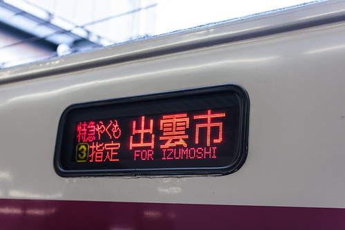
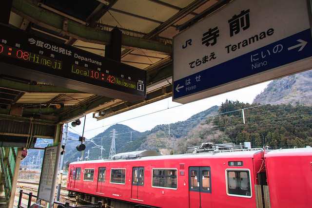
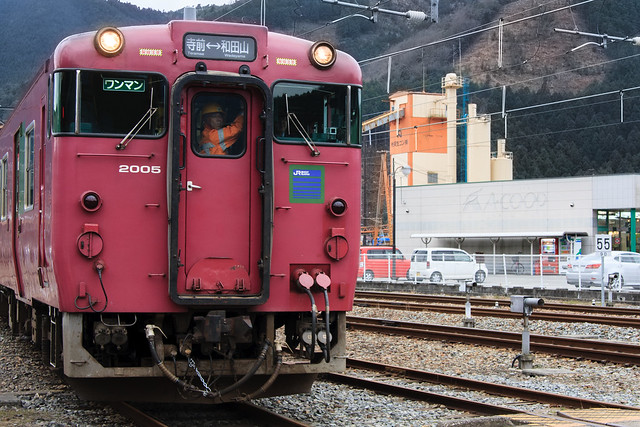
Currently the Bantan Line is only electrified in the most used portion from Himeji to Teramae Station (寺前駅). The rural and quasi-wilderness section heading from Teramae to Wadayama is run using diesel trains. Because of this there are no local trains that run the entire length of the line, although most trains run on a relay system to reduce layover time. The Bantan Line also hosts the Hamakaze (はまかぜ) limited express train heading from Osaka to Tottori with stops at 5 stations on the Bantan Line, including Himeji and Wadayama.


20130106-BantanLine-1

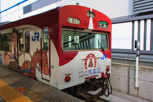
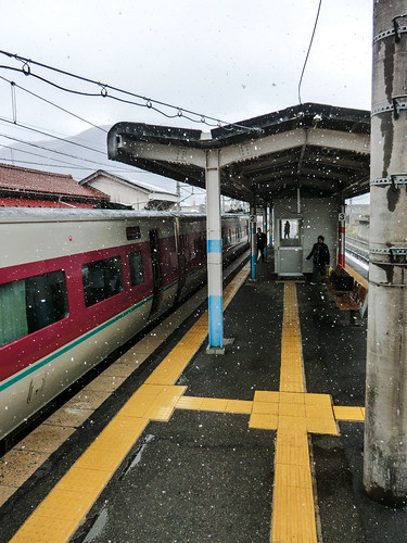
I traveled the Bantan Line on January 6, 2013 leaving from Himeji around 9am. This was the second time I’ve taken this line, but the first time heading from Himeji and the first time in the daylight. The two car train was decorated in commemoration of the Gin no Bashamichi (銀の馬車道), a Meiji era 49km road for horse drawn carts connecting Ikuno to Himeji which was a predecessor to the modern highway in Japan. The two car conductorless train was not packed and I had more than enough space to myself. Be aware that the Bantan Line is not equipped for using IC chip smartcards like Icoca or PiTaPa, so you’ll have to pay in cash upon exiting the train or buy a ticket from a machine beforehand.

Leaving Himeji Station the line makes a long slow curve towards the mountains and offers a few views of Himeji Castle before leaving the main area of Himeji City. At Nozato Station (野里駅), the second station after leaving Himeji, there is an entertainment complex with a super sento and public park. Soon after that the tracks go under the Sanyo Expressway and the housing becomes more spread out with some newly built single family housing. Instead of being in a slope heading to the ocean like most of the area between Osaka and Himeji, the landscape becomes a wide valley bordered by low hills. Houses get bigger and some heavy industrial plants come in to view including a large Nestle plant.

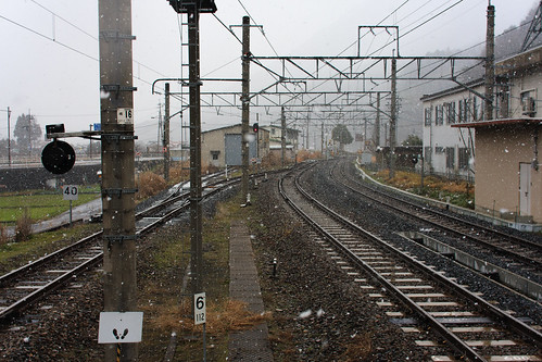
After Mizoguchi Station (溝口駅) the line turns to single track and begins to climb the side of the mountains and passes under the Chuo Expressway. By the next stop, Fukuzaki Station (福崎駅), there were only 3 people in the rear car with me and the front one had only 45% of the seats filled. Past Fukuzaki Station I doubt that many people commute by train into Kobe or Osaka for work. Traveling on the valley gets tighter and tighter while the number of buildings gets smaller and smaller--gaudy pachinko parlors being the constant.

The morning’s weather was overcast and the view is limited by a low, dense fog. A farmer’s fire in the far distance brings just a hint of its smoky smell into the train. The hint of campfire smelling smoke mingling with the cold winter air was intoxicating. I had one of those moments of clarity about why I enjoy this somewhat odd hobby.

At Niino Station (新野駅), one stop before Teramae, there are only 5 people in the train. The landscape is mostly rice fields with traditional houses built along the sides of the hills to allow as much of the scarce flat land to be used for agriculture. The valley closes in along the Ichikawa River and the electrified part of the line ends.

20130106-BantanLine-6

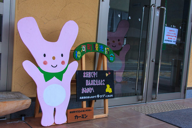
Teramae Station is the main station in the rural town of Kamikawa (神河町). Connected to the station is a small community center that is decorated with images of the local mascot Kamin (カーミン). Opposite the tracks from the station is a gravel or ore processing and loading area for container trains and further on beyond that is the river. There is a small market and very rural looking shopping street also nearby.


20130106-BantanLine-7

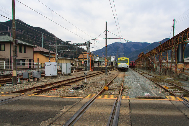
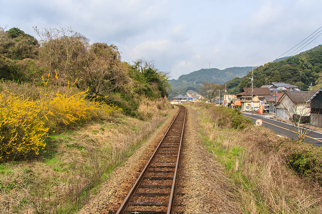
Right after leaving Teramae a huge mined out mountain comes into view on the riverside. I recommend sitting on the eastern side of the train for the best views. The non-electrified section of the Bantan Line is longer, 37.9km of the entire 67.5km length, but the travel time is much shorter as there are only 5 stations compared to 12 on the electrified portion. This is the dramatic part of the ride. Great tree covered hills above and a fast flowing river below. If you look carefully you can see where some sections of the mountains have been logged and replanted. Some spotty snow and ice is still visible from the train. The river looked like it would be good for fishing in the right weather.

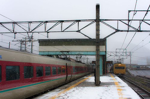
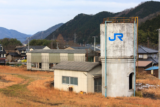
Coming into Wadayama the valley widens and more houses are noticeable. Eventually a few pachinko parlors appear then the signs of the modern Japanese city and the chain store signs that come with it appear across the river where the heavily traveled roads are. Wadayama is a major station with most amenities within a short walking distance. There is an old JR water tower and train shed across the tracks that have become the image of the station. The station building itself is somewhat modern with rounded corners and a small park along the tracks. I took a 30 minute or so walk to get to the local super sento which I thoroughly enjoyed. The area right around the station has many old buildings and small streets to explore. Most of the major shopping is along national highway across the river however.

20130106-BantanLine-16

The Bantan Line is not one of the most dramatic or interesting rides in the JR West area, but it is very enjoyable and has a few highlights. The old water tower at Wadayama, the riverside ride just north of Teramae, and the mining apparatus visible from Teramae Station all are worth checking out for train fans. Getting there and back in a day is easy for someone looking for an easy train trip to get out of the city and can be made part of a loop returning via Fukuchiyama, to Kyoto, Osaka, or Kakogawa. My loop went as follows: Sannomiya - Himeji - Wadayama - Fukuchiyama - Tanigawa - Nishiwaki - Kakogawa - Sannomiya.


Tuesday, April 16, 2013

Nagasaki City on a Rainy Day

20130322-NagasakiCity-1

If you've never made it down to Nagasaki, I cannot recommend it more. It's a great place to get lost walking around the backstreets. Amazing food everywhere. Easy transportation to and from the many historical and cultural sites. It seemed that it would be very easy for non-Japanese speakers to navigate also.

Photos: Nagasaki City / 長崎市


Friday, April 05, 2013

Matsuura Railway - Nishi Kyushu Line 松浦鉄道西九州線

20130323-MatsuuraRailway-9
Location Name: Matsuura Railway - Nishi Kyushu Line 松浦鉄道西九州線
Type: Railway Line 列車線
Location: Nagasaki and Saga Prefectures, Kyushu, JAPAN
Terminals: Sasebo Station, Imari Station, Arita Station
Distance: 93.8km
Number of Stations: 57

Photos: Matsuura Railway / 松浦鉄道

The Matsuura Railway (松浦鉄道) loops around the Kita-Matsuura Peninsula in the western portion of Kyushu through Nagasaki and Saga prefectures. The line was originally called the Matsuura Line before the break up of the JNR in the late 80’s, but is now called the Nishi Kyushu Line (西九州). It is currently run as a class 3 railway and owned by Nagasaki Prefecture and local transportation and industrial interests.

Going up from the South and looping up clockwise, following my route, the line starts in Sasebo (佐世保). This port city is famous for its hamburgers and the home to a large United States Navy base. The station is quite large with elevated tracks. A single escalator in the northwestern corner of the concourse provides access to Matsuura Railway’s ticket machines and platform based ticket booth. 

I bought the ¥2,000 one day free ticket from the man in the booth, who went out of his way to get me one. I think you can buy them on the train, however. The “Free Ticket” (フリーきっぷ) offers one day on the trains allowing you to get on and off as you please. Traveling from Sasebo to Imari (伊万里) is ¥1,950 so it is worth buying if you plan to ride the entire line.

Initially, I thought this ride was going to be quite basic and I was only riding it to be a completionist. It turned out to be one of the most beautiful rail lines I’ve been on. 

The Matsuura line leaves Sasebo Station through a valley of buildings on an elevated track. The city is quite built up. Sasebo is a city much like Nagasaki in that the city is built into the mountains. Small tunnels open up into little valleys full of haphazardly placed homes. The train is elevated to a degree so you can look down on the little streets and houses. I thought it would turn rural much faster, but the city seemed to continue on and on into the mountains. This part of the line reminded me of Shintetsu and driving through western Kobe. 

It is on this first stretch that the line passes Sasebo-chuo (佐世保中央) and Naka-Sasebo (中佐世保) stations. Both names mean pretty much the same thing and the two stations are a mere 200m apart. This is the shortest distance between any two train stations in Japan--streetcars and cable cars excluded. I was on an express and didn’t even notice passing by Naka-Sasebo station.

At around Motoyama station the landscape becomes more rural/residential as the train crosses a many small valleys and goes through many small bucolic tunnels. Make sure to check out the very fun looking new playground and unique public toilet as you reach Kora Station (小浦).

20130323-MatsuuraRailway-7
I planned a layover at Saza station (佐々) and was very glad I did. The station itself is modeled after a log cabin and is very welcoming. Not much around the station as far as stores go, but it was fun to explore. The air had a natural fresh spring scent to it. Leaving Saza the tracks follow the river of the same name. The next train car I got on was much more packed and not as new as the first one I rode. There was a group of grandparents on a hiking excursion sponsored by the railway and a large group of young people all in black for a funeral as I later discovered.  Both groups piled out of the train at the same station in a mass exodus that was quite a sight to see. 

As the line reaches the tip of the Kita-Matsuura Pennisula the train makes a brief stop at Tabira-Hiradoguchi Station (たびら平戸口). Excluding the monorail in Okinawa, this is the westernmost train station in Japan. I didn’t realize this until I got on the train and saw a pamphlet advertising the fact. Just like Nishi-Oyama (西大山), the southernmost station, the train holds for a few minutes to allow us train people to snap a few quick photos. Be careful though, the train almost left with my bag, but not me on board!

20130323-MatsuuraRailway-11
From Tabira-Hiradoguchi the view gets a little boring. Coming into the namesake village of Matsuura, there are a few large factories and a power station to look at. There are no toilets in the trains so make use of the short stop at Matsuura Station if needed. Leaving Matsuura the landscape gets increasingly built up with stores and houses. Some nice views of the sea do pop up. Imabuku Station (今福) is lined with sakura trees which were in bloom when I passed by. Photographers along the side of the tracks were so close that the engineer had to blow the horn at them so they would move back to a safe distance.

The train pulls to a stop at Imari Station where the JR and Matsuura sides are bisected by a road. There is a supermarket, restaurants, and convenience stores near by. In the station is a very helpful tourist information desk that also sells local products where I picked up some omiyage.

20130323-MatsuuraRailway-13
After exploring around Imari Station, heading to a shrine with some beautiful sakura, and hiking up the hill to a highly recommended supersento, I got on the train for the last haul to Arita. This portion of the line goes through a pleasant valley bounded by some tallish looking mountains. At Arita Station the Matsuura train pulls into a far platform of the JR station. The building at Arita has a small staffed ticket booth for the Matsuura Railway along with the JR one.

I really enjoyed riding this line. There seemed to be a lot of community support for it. The trains were clean and the staff was cheerful. If you get a chance to ride this line, I would go for it.

Matsuura Railway - Nishi Kyushu Line 松浦鉄道西九州線 at EveryTrail


Saturday, March 09, 2013

Kurayoshi - Shirakabe Dozogun 倉吉市ー白壁土蔵群

Place Name: Shirakabe Dozogun 白壁土蔵群
Type: Historical Preservation District 
Location: Kurayoshi city, Tottori Prefecture, JAPAN 
Latitude: 35.432089 
Longitude: 133.825031 
Date of Visit: December 28, 2012 
Access: JR San'in Main Line - Kurayoshi Station (山陰本線ー倉吉駅) 
Web: http://www.apionet.or.jp/kankou/f/e/html/midokoro1.htm#shirakabe
Photos: http://www.flickr.com/photos/sleepytako/8540022875/

20121228-Kurayoshi-3

The Shirakabe Dozogun [白壁土蔵群] or Utsubukitamakawa [打吹玉川] as it's officially known is a "Group of Traditional Building" or in Japanese a 重要伝統的建造物群保存地区. Basically, it's a historic district of warehouses dating back to Edo period that have been preserved over the years. The beautiful neighborhood can be explored in a half day and has many small, and tasty looking, cafes hidden throughout the area. Small shops aimed towards the tourist trade are mixed among local shoe stores and boutiques. Even in the rain we had a great time wandering around the small streets.

Free parking and, lucky for us, free umbrella rental is available near the tourist information office.


Created with Admarket's flickrSLiDR.

View Larger Map

Tuesday, March 05, 2013

Kokawa-dera 粉河寺 #3

Place Name: Kokawa-dera 粉河寺 
Type: Temple 寺 
Location: Kinokawa city, Wakayama Prefecture, JAPAN 
Latitude: 34.280961 
Longitude: 135.405908 
Date of Visit: February 11, 2013 
Access: JR Wakayama Line - Kokawa Station (和歌山線ー粉河駅) 
Fee: Parking ¥500 
Hours: 8:00~17:00 
Web: http://www.kokawadera.org/ 
Photos: http://www.flickr.com/photos/sleepytako/sets/72157632920596244

20130211-Kokawadera-5

Kokawa-dera is impressive for the beautiful stone work throughout the complex. Easy to walk to with no long stairs or hikes from the entrance it's also one of the most accessible of the Saikoku 33 temples. If you don't come by car, it's only 10 minutes or so from the nearest train station to the entrance also. The gem of Kokawa-dera is the amazing rock garden that makes up the retaining wall of the temple. It's also registered national cultural asset. While the garden dates from the 16th century the temple itself has a history dating back to 770. A picture scroll describing the foundation of the temple by a hunter is a natural treasure and is kept in the Kyoto National Museum. The lotus flower fountain in the front is amazing too. Behind the temple is a small Shinto shrine that had a two peacocks and some koi fish to look at. 

The hill next to the temple is a city park with a small playground, view point and walking trails.


Created with Admarket's flickrSLiDR.

Sunday, February 17, 2013

Izumotaisha-Mae Station - 出雲大社前駅

20121226-IzumotaishamaeEki-2

Place Name: Izumotaisha-Mae Station - 出雲大社前駅
Type: Train Station 駅
Location: Izumo City, Shimane Prefecture, JAPAN
Latitude: 35.393569
Longitude: 132.687108
Date of Visit: January 4, 2006 & December 26, 2012
Access:  Ichibata Electric Railway
Average Daily Passengers (2010): 504 
Date Opened: February 3, 1930
Flickr Set:  http://www.flickr.com/photos/sleepytako/sets/72157632780838439/


Izumotaisha-Mae Station is a beautiful example of what a Japanese railway architecture can be. Stepping into this newly restored 1930's station you can feel the energy from that time long ago. The old ticket booths, hand cracked departure board and stained class windows stand out, but simple things like the heavy doors and benches help to produce a magical atmosphere. The Ichibata trains behind the station show the wear and tear of years gone-by but they still creek and shuffle down the rails without a sign of giving up. When I first came here in 2006 unaware of exactly where I was going or what I was doing, I could feel the something ethereal about this train line and the shrine it gives access to.  These relics of the past that are still alive are a part of the living history that is always just around the corner in Japan.


Created with Admarket's flickrSLiDR.

Monday, January 14, 2013

Izumotaisha - 出雲大社

20121226-izumotaisha-2

Location Name: Izumotaisha - 出雲大社 
Type: Shinto Shrine - 神社 
Location: Izumo City, Shimane Prefecture 
Access: JR Izumo-shi or Ichibata Izumotasha-mae 

20121226-izumotaisha-4
The main shrine
Izumotaisha is the second most important shrine to the Shinto faith. Only the Shrine in Izu is revered higher. Being the home to some of Japan’s oldest archeological finds Izumotaisha is also the oldest Shinto shrine. It abuts the hills that make up the Shimane Peninsula and separate the Izumo plain from the Japan sea. The plain is made up of relatively flat farm land that has been cut up with rivers and canals. It bears a slight resemblance to the Imperial Valley of California. To the east and west the plain is set between the Japan sea and the brackish Lake Shinji. The landscape is utilitarian, but not dramatic. That said, it does look like it was an ideal place for early humans to develop agriculture.
20121226-izumotaisha-6
Parts of the shrine are still being repaired
In the shinto faith it is believed that the gods all congregate in November at Izumotaisha. In basic Japanese the months named after their order. November becomes [10月] or “tenth month.” There is a secondary set of names for the months that appears in traditional calendars and dates. November’s traditional name is Kannazuki [神無月] literally “no gods month.”
20121226-izumotaisha-8
The god enshrined at Izumotaisha is called Okuninushi who, as a young man, helped heal the White Rabbit of Inaba. He is known as the god of enmusubi [縁結び] or matchmaking. When one prays at the shrine it is custom to clap four times instead of the typical two. The first two claps are for yourself and the second two are for your future (or current) spouse. When I first came to Japan on a cold January night in 2006 I stumbled into Izumotaisha late one night and prayed for my future clapping four times. In a mere two years later I married my amazing spouse Yuko. Now my experience might not match your own, but It’s worth a try if you’re looking. Enmusubi has also taken on the meaning of expanding one’s circle of friends and being more personable. Charms, amulets and chopsticks enchanted with the spirt of enmusubi are sold in the shrine and stores around it.
20060104-izumotaisha-1
A 2006 photo of the shrine. This area is currently under construction as of January, 2013
The shrine’s buildings have a design that is unlike any other one that you might have visited. I find the design helps produce a sense of awe and mystery when exploring the site. Everything from the trees in the garden to the moss growing on the roof have an aura of august maturity. As is common with Shinto shrines, the gardens and walkways leading to the buildings all glorify nature it’s elegant power.
20121226-izumotaisha-7
Kaguraden and shimenawa
Located to the side of the main temple complex is the Kaguraden. Dating from 1776, the building itself is new looking and not as appealing as the unique design of the main shrines. It does have a the largest shimenawa, a type of devotional rope made of straw, weighing 5 tons hanging from the 13.5 meter long entranceway. A popular sight typically shown on most of the pamphlets advertising the shrine to tourists. I cannot recommend a visit to Izumotaisha and the San’in area more.

20121226-izumotaisha-5
Shimenawa
20121226-izumotaisha-3
Main entrance
20121226-izumotaisha-9
New Year's sake on display
20121226-izumotaisha-10
Looking back towards the entrance

Wednesday, January 02, 2013

JR West Hakubi Line - JR西日本伯備線

JR West Hakubi Line - JR西日本伯備線 


20121226-HakubiLine-5
Looking towards Yonago at Neu Station

Location Name: JR West Hakubi Line - JR西日本伯備線
Type: Railway Line 列車線
Location: Tottori and Okayama Prefectures, Chukoku Region, JAPAN
Terminals: Kurashiki Station, Hoki-Daizen Station
Distance: 138.4km
Number of Stations: 28 


20121226-HakubiLine-1

The Hakubi Line is a major north-south train line cutting across the Chukoku region of Honshu. It begins in Kurashiki when the Hakubi Line splits from the Sanyo Main Line just after leaving the station. From Kurashiki the line follows the Takahashi River up into the mountains through mostly flat farmlands and semi-rural sprawl. The line is shared with the private Ibara Railway for its single line from Kiyone to Soja. Also at Soja the Kibi Line, a short, commuter line that serves the upper parts of the Okayama plain, ends. From Soja the line follows the river, goes through tunnels, and cuts across small agricultural valleys as it makes it was into the mountains. Mining and light industry is also visible from the line. Only two local trains run the entire Hakubi line in one shot heading all the way to Yonago. The remainder stop at Bitchu-Takahashi or Niimi. On those trains to Niimi most of the passengers will get off by Bitchu-Takahashi. After that station the train enters even more rural areas and the line becomes primarily single track till the terminal in Tottori prefecture. Between Bitchu-Takahashi and Niimi the train passes by Ikura station which provides access to the Ikura Cave a regional tourist attraction.

20121226-HakubiLine-2
 

Niimi is an important transportation hub for JR West. It is the middle point in a line of three major stations in the mountainous center of the Chukoku region. Miyoshi to the West and Tsuyama to the East are the other two. I have been through all three of the stations at least twice and all have been featured on this blog. The Kishin Line from Tsuyama and Himeji terminates here and trains heading west on the Geibi Line to Miyoshi and Hiroshima originate here.

20121226-HakubiLine-3

20121226-HakubiLine-7
Snow at Neu Station. The yellow train is a local for Yonago.

The next station past Niimi is called Nunohara. While technically on the Hakubi line no Hakubi Line train stops at the station. The average of one person a day who uses the station must either ride one of the trains headed for the Geibi line back to Niimi or on to Bingo-Ochiai and Miyoshi. Nunohara station used to be important as a staging area when steam trains were still in service but lost importance when the rolling stock was upgraded to diesel. Moving on past Nunohara is Bitchu-Kojiro when there Geibi Line officially begins. Between Bitchu-Kojiro and Kami-Iwami the line reaches its highest point, crosses the border into Tottori and the control is changed from Okayama to Yonago. After entering Tottori the train will begin it’s decent towards the Sea of Japan. Beautiful farmland and the Hino River can be seen along the track as it crosses through this sparsely populated part of Honshu.

20121226-HakubiLine-4
Neu Station


20121226-HakubiLine-8
Hino-cho
Our express train had a 2 hour delay at Neu due to an electrical failure at Hoki-Daisen Station. Neu Station is located in front of the Hino City Office in the most developed part of the 3,500 person village. Neu was the original name of the village until 1959. During the wait I took a quick walk down the street from the train and found a small liquor store, a few hair dressers, a Shinto shrine, a city cultural center, and a bank. The opposite side of the station had a large home center, a convenience store, and a gas station. After Neu the train soon leaves the mountains and the wide rice fields appear as you skirt by the 1729m peak of Mt. Daisen on the East. The Hakubi Line then merges with the San’in Main Line at Hoki-Daisen and continues on to Yonago for the local trains, or past Yonago to Izumo-shi for the express trains. The Hakubi Line is the busiest between Okayama and Niimi and trains run about hourly. Local trains from Niimi down to Yonago are less frequent with only 8 each day. In the morning the Sunrise Izumo overnight train from Tokyo runs the line leaving Okayama at 6:34. During the day once an hour between 7am and 9pm the Super Yakumo runs between Okayama and Izumo-shi. Local trains are typically one or two cars with a toilet. The Super Yakumo is an express train with toilets and sinks but no vending.

20121226-HakubiLine-6

The Hakubi Line is the workhorse of the lines connecting the San’in (Japan Sea side) to the Sanyo (Seto Inland Sea side) of Japan [陰陽連絡路線]. None of the other lines run express trains for the entire length. This means the ride is less dramatic as parts of the Inbi or Kibi lines, and there is not as much absolute wilderness along the ride. The line is still a great way to see some of the less explored parts of Japan with some great scenery along the route. It also provides access to Yonago and Matsue two of my favorite cities both with history, cuisine and abundant hot springs.


Hakubi Line Ekiben
Left: Omusubi Kororin Right: Bise  

Okayama station has a large selection of Ekiben for the trip. On the way from Okayama to Izumo-shi I had the Bisei bento with beef and pork on a bed of rice. Yuko had the Omusubi Kororin a two box bento with a collection of small onigiri on the bottom and various little things on the top.


The name Hakubi (伯備) comes from Hoki Province (耆の国) which used to be the area around Yonago in western Tottori Prefecture and Bitchu Province (中国) which is now western Okayama Prefecture. The names Bitchu and Hoki are used in station names along the line to differentiate them from stations with the same names in other regions.

Hakubi Line - 伯備線 at EveryTrail