Location Name: JR West - Bantan Line JR西日本 – 播但線
Type: Railway Line 列車線
Location: Hyogo Prefecture, Honshu, JAPAN
Terminals: Himeji Station, Wadayama Station
Distance: 65.7km
Number of Stations: 18
Photos: BantanLine – 播但線
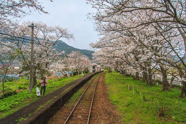
The Bantan Line (播但線) and Kishin Line (姫新線) both leave from the same platform closest to the mountain side of JR Himeji Station (JR姫路駅). They are in the backwater of this vital station in the JR West system. If you imagine a parabola, Himeji Station is at the bottom. Rising up and to the left is the Kishin Line heading towards Tsuyama, Okayama (岡山県津山市). Rising up to the right is the Bantan Line which connects to the San’in Main Line (山陰本線) at Wadayama Station (和田山駅) in Asago, Hyogo (兵庫県朝来市). Both of these lines serve the suburbs and quasi-rural areas around Himeji feeding workers to places as far as Osaka, over 100KM away, on a daily basis. Once past the suburban portion, these lines act as conduits between the more important and heavily used routes while offering service to some of Japan’s bucolic rural landscapes.
Bantan is a connection of two kanji, the “ban” (播) can also be read as “hari” in Harima (播磨) which is the traditional name of the region around Himeji. The “ta” (但) comes from Tajima (但馬), the region just to the north of Harima/Himeji known for its beef production. If you look around, you will likely see both Harima and Tajima appear quite often in stations, companies and products; especially if you spend some time in Hyogo Prefecture.
The Bantan Line has a history going back to 1894 when the original line was built by the private Bantan Railway (播但鉄道). The railway was later purchased by the also private Sanyo Railway (山陽鉄道). During ownership by Sanyo Railway in 1906 the line was completed all the way to Wadayama Station. A few months later the entire Sanyo Railway was nationalized. It was then that the Bantan Line and the Sanyo Main Line (山陽本線) running from Kobe to Shimonoseki at the tip of Honshu among others became parts of JR West as we know it today. It is important to note that the current Sanyo Electric Railway (山陽電車) and the former Sanyo Railway are different companies. Sanyo (山陽) is a geographical term describing the south facing coast of Honshu from Osaka to Shimonoseki along the Seto Inland Sea.
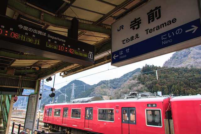
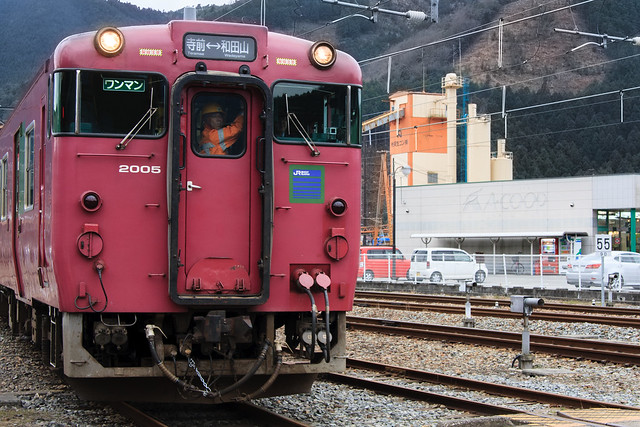
Currently the Bantan Line is only electrified in the most used portion from Himeji to Teramae Station (寺前駅). The rural and quasi-wilderness section heading from Teramae to Wadayama is run using diesel trains. Because of this there are no local trains that run the entire length of the line, although most trains run on a relay system to reduce layover time. The Bantan Line also hosts the Hamakaze (はまかぜ) limited express train heading from Osaka to Tottori with stops at 5 stations on the Bantan Line, including Himeji and Wadayama.
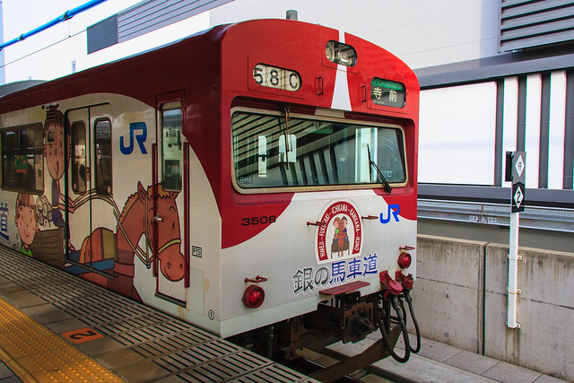
I traveled the Bantan Line on January 6, 2013 leaving from Himeji around 9am. This was the second time I’ve taken this line, but the first time heading from Himeji and the first time in the daylight. The two car train was decorated in commemoration of the Gin no Bashamichi (銀の馬車道), a Meiji era 49km road for horse drawn carts connecting Ikuno to Himeji which was a predecessor to the modern highway in Japan. The two car conductorless train was not packed and I had more than enough space to myself. Be aware that the Bantan Line is not equipped for using IC chip smartcards like Icoca or PiTaPa, so you’ll have to pay in cash upon exiting the train or buy a ticket from a machine beforehand.
Leaving Himeji Station the line makes a long slow curve towards the mountains and offers a few views of Himeji Castle before leaving the main area of Himeji City. At Nozato Station (野里駅), the second station after leaving Himeji, there is an entertainment complex with a super sento and public park. Soon after that the tracks go under the Sanyo Expressway and the housing becomes more spread out with some newly built single family housing. Instead of being in a slope heading to the ocean like most of the area between Osaka and Himeji, the landscape becomes a wide valley bordered by low hills. Houses get bigger and some heavy industrial plants come in to view including a large Nestle plant.
After Mizoguchi Station (溝口駅) the line turns to single track and begins to climb the side of the mountains and passes under the Chuo Expressway. By the next stop, Fukuzaki Station (福崎駅), there were only 3 people in the rear car with me and the front one had only 45% of the seats filled. Past Fukuzaki Station I doubt that many people commute by train into Kobe or Osaka for work. Traveling on the valley gets tighter and tighter while the number of buildings gets smaller and smaller--gaudy pachinko parlors being the constant.
The morning’s weather was overcast and the view is limited by a low, dense fog. A farmer’s fire in the far distance brings just a hint of its smoky smell into the train. The hint of campfire smelling smoke mingling with the cold winter air was intoxicating. I had one of those moments of clarity about why I enjoy this somewhat odd hobby.
At Niino Station (新野駅), one stop before Teramae, there are only 5 people in the train. The landscape is mostly rice fields with traditional houses built along the sides of the hills to allow as much of the scarce flat land to be used for agriculture. The valley closes in along the Ichikawa River and the electrified part of the line ends.
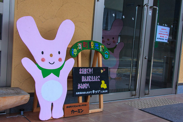
Teramae Station is the main station in the rural town of Kamikawa (神河町). Connected to the station is a small community center that is decorated with images of the local mascot Kamin (カーミン). Opposite the tracks from the station is a gravel or ore processing and loading area for container trains and further on beyond that is the river. There is a small market and very rural looking shopping street also nearby.
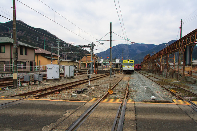
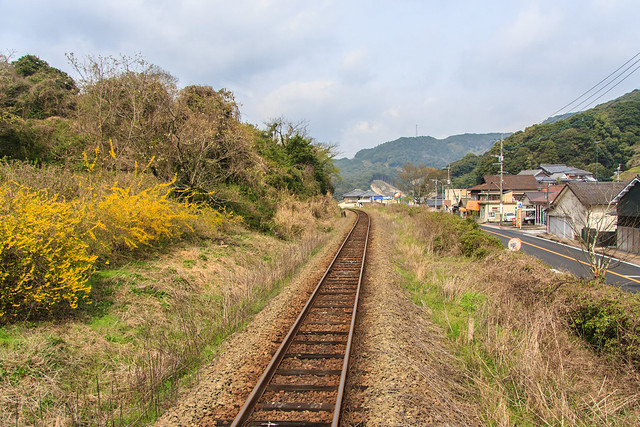
Right after leaving Teramae a huge mined out mountain comes into view on the riverside. I recommend sitting on the eastern side of the train for the best views. The non-electrified section of the Bantan Line is longer, 37.9km of the entire 67.5km length, but the travel time is much shorter as there are only 5 stations compared to 12 on the electrified portion. This is the dramatic part of the ride. Great tree covered hills above and a fast flowing river below. If you look carefully you can see where some sections of the mountains have been logged and replanted. Some spotty snow and ice is still visible from the train. The river looked like it would be good for fishing in the right weather.
Coming into Wadayama the valley widens and more houses are noticeable. Eventually a few pachinko parlors appear then the signs of the modern Japanese city and the chain store signs that come with it appear across the river where the heavily traveled roads are. Wadayama is a major station with most amenities within a short walking distance. There is an old JR water tower and train shed across the tracks that have become the image of the station. The station building itself is somewhat modern with rounded corners and a small park along the tracks. I took a 30 minute or so walk to get to the local super sento which I thoroughly enjoyed. The area right around the station has many old buildings and small streets to explore. Most of the major shopping is along national highway across the river however.
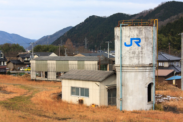
The Bantan Line is not one of the most dramatic or interesting rides in the JR West area, but it is very enjoyable and has a few highlights. The old water tower at Wadayama, the riverside ride just north of Teramae, and the mining apparatus visible from Teramae Station all are worth checking out for train fans. Getting there and back in a day is easy for someone looking for an easy train trip to get out of the city and can be made part of a loop returning via Fukuchiyama, to Kyoto, Osaka, or Kakogawa. My loop went as follows: Sannomiya - Himeji - Wadayama - Fukuchiyama - Tanigawa - Nishiwaki - Kakogawa - Sannomiya.
